Hiking on a marked trail can seem like an easy task at first. There are innumerable trailheads to start from across the country, and each one typically has a map of the area as a guide. Even if you come ill prepared, most people can take a photo of the trailhead map with their phones or make a sketch with whatever they happen to have with them. In some places where trails are more popular, there are dedicated navigation apps to help ensure you get the most enjoyment out of your adventure. But even with all this redundancy available, outdoor enthusiasts can still find themselves navigating without tools to guide them.
One of the most common ways that people find themselves lost in the wilderness without any tools to guide them, is by stepping off the beaten path to relieve themselves. Often these soon-to-be lost people will ground their gear on the trail so they can get out of sight in a more agile way. Then they travel far enough away from the trail so that no other passers-by can see observe them doing their business. Upon completion, they confidently head back to where they assume the trail and their gear is located, and this is where things go awry.
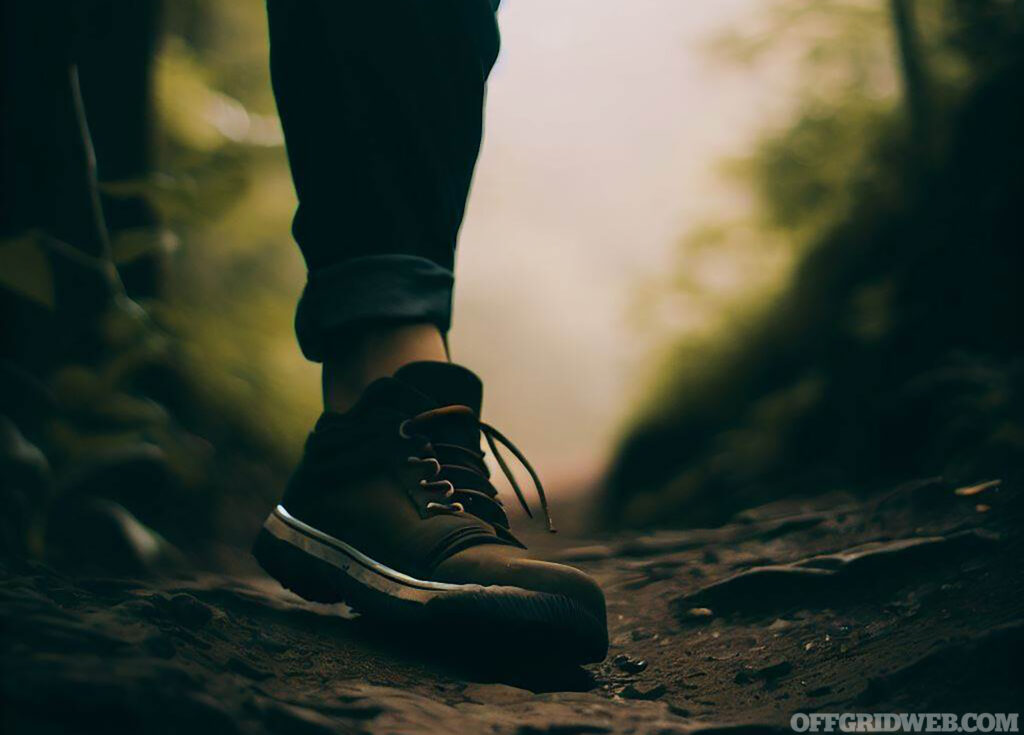
Above: Stepping off the trail briefly may seem harmless at first, but can quickly lead to a disorienting event.
Walking back to the trail, the now lost individual may not feel immediately disoriented until they realize the walk back is taking much longer than they expected. But once they realize the trail isn’t where they thought it was, they are hit with an overwhelming feeling of dread. Maybe panic sets in as they frantically search for the trail, which is deceptively more difficult than they assumed it would be. This situation can escalate quickly into a life-threatening situation if the lost person doesn’t quickly get a grip on the situation or take the appropriate actions. What should someone do in this situation? Let’s learn some easy ways to prevent becoming lost, even if you are left with nothing but the clothes on your back.
Planning Ahead
An ounce of prevention is worth a pound of cure, so before you venture into the wild, planning is essential. This sort of planning can prevent a worst case scenario such as having to navigate the wilderness without any tools. It’s much like setting out on a road trip – you wouldn't start without knowing your destination, right? Similarly, it's imperative to familiarize yourself with your route, identify key features, potential hazards, and have a few contingency plans for those hazards before heading out. A good map reconnaissance will equip you with valuable information about the terrain, water sources, and distinguishing landmarks. Knowing how to read and interpret a map is an invaluable skill, and thankfully, there are many sources out there to learn map reading from.
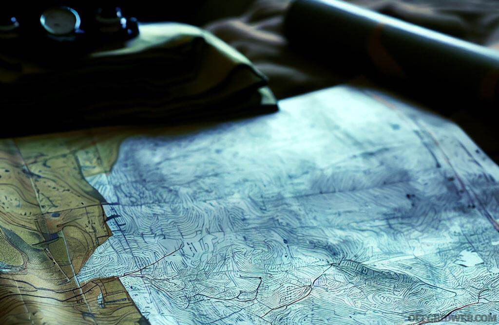
Above: Looking at a map, even if it is the crude park map posted at the trailhead, can give you a better idea of where you are going, and maybe even prevent becoming lost. A good rule of thumb is to have a paper back up, and a photo on your phone.
The wilderness doesn't offer printed road signs, but it does make certain geographical features more obvious than others. Establishing an emergency bearing – a direction leading to a large, noticeable feature or civilization – before you head out is key. It could last resort when all else fails, and it is a very simple thing to do. For example, while looking on your map, you may notice a town or city nearby your intended destination, or a river, or a powerline. Any of these features could help you find help or lifesaving resources. Simply note what the direction is, so if you become lost, you can head in that general direction knowing that you will eventually run into the feature.

Above: Power-lines, highways, and major waterways are easy to identify landmarks that can be used to find your way back to safety, but they must be identified before you head out.
Packing wisely should be a no brainer, pre-trip task. Along with your basic necessities, always bring signaling equipment like mirrors, whistles, or flares. Knowing how to use those tools is just as important as brining them along. For example, blowing whistle three times in a row, may sound like the call of bird to someone searching for you in the distance, whereas one long continuous whistle will capture their attention quickly. There are a bunch of other emergency signaling techniques to choose from, just ensure you know a few of the most effective for the area you’ll be in. Think of them as your lifeline, connecting you to the outside world.
Preparing for the elements will keep you alive the longest. Most people who die while they are lost in the wilderness succumb to what is known as exposure. This means that their body could no longer regulate its own temperature, and is caused by becoming either too hot or too cold for too long. The wilderness can be as kind as it is harsh, and knowing what weather to expect helps you to dress appropriately, manage your energy, and overall, make your journey safer.
Feeling Lost
Understanding what happens when you realize you are lost could help you make smarter decisions. When you look around and notice that you are not where you should be or start feeling uncertain about where you may be heading, your body reacts instantly. Catecholamines – like adrenaline and epinephrine – kick in, triggering the fight, flight, or freeze response. You might feel disoriented, panicked, or anxious. This is where the STOP method comes into play: Stop, Think, Observe, and Plan. The act of consciously thinking about your situation, what your options are, and what resources you have at your disposal can slow or halt the flow of catecholamines. It's a powerful tool to regain control of your emotional response and make rational decisions.

Above: The human is just as prone to fear as other animals. Being able to recognize and acknowledge what you're feeling will help keep those emotions under control in a stressful situation.
One useful technique to control those heart-pumping hormones is to sit down and dump your pockets. Take inventory of what you have – anything could be a potential survival tool, and this where you should get the most creative about improvising your way out of the situation. Evaluate whether it's best to stay put and make yourself visible, or to start moving to a location with a higher likelihood of discovery. As a rule of thumb, if you're close to a well-traveled route, it's often wise to stay put and signal for help. But perhaps finding higher ground would get you to a place where you get better cellphone coverage, or a better vantage point to reorient yourself. It’s situationally dependent, but more often than not, staying put leads to the highest chance of being discovered by a rescuer.
Navigating by Day
The sun is your daytime guiding star. In the northern hemisphere, it’s due south when at its highest, and due north in the southern hemisphere. This simple information can be used to keep your bearings. You can take this a step further by creating a makeshift compass using a stick and some stones. Place a stick vertically in the ground and mark the end of its shadow with a stone. Wait for a while and mark the new position of the shadow. The first mark indicates west, and the second one, east. However, this method only works when the sun is visible. On a cloudy day, you can still figure out your bearings by using a thin, straight object and a flat surface like your fingernail. The sun’s position, even when not directly visible, will cast a shadow, indicating its direction.
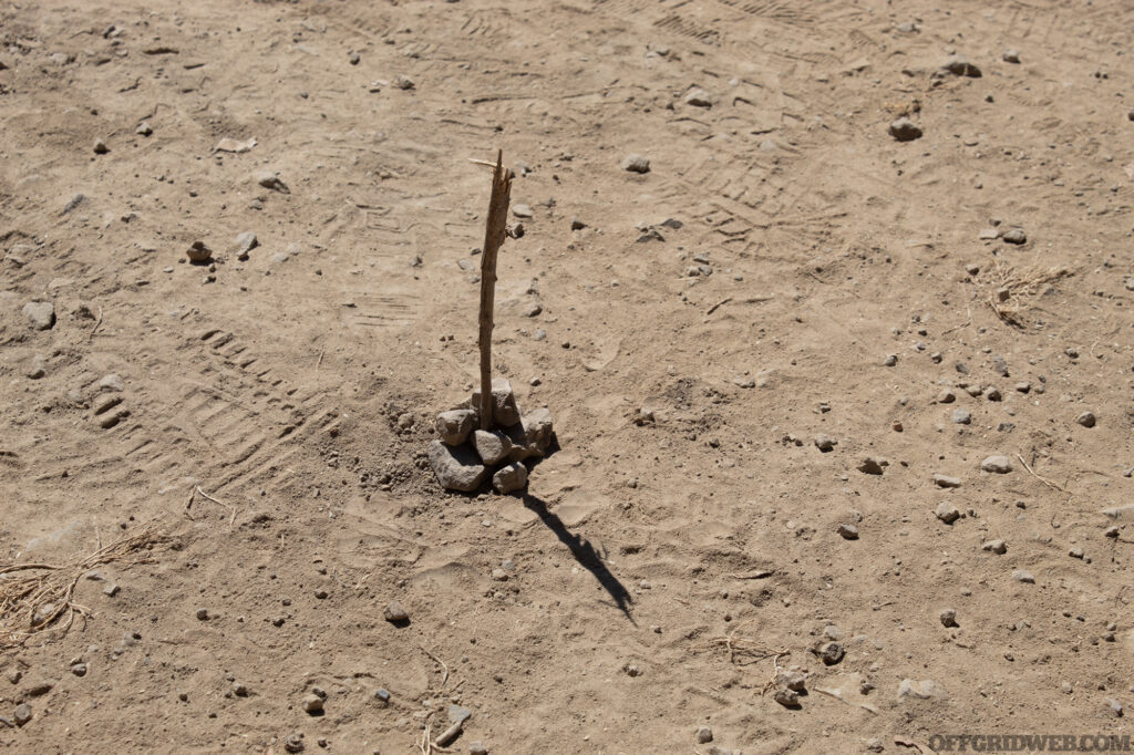
Above: In full sun, just placing a stick in the ground and waiting a few minutes for the shadow to move will help reestablish your sense of direction. In the northern hemisphere, the shadow points generally north, but its accuracy depends on the time of day.
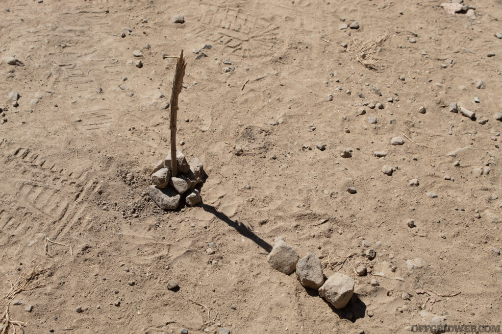
Above: Once you place a straight stick in the ground, mark the initial point of where the shadow lies. It may be helpful to mark it with something that will be easy to identify later so you don't lose track.
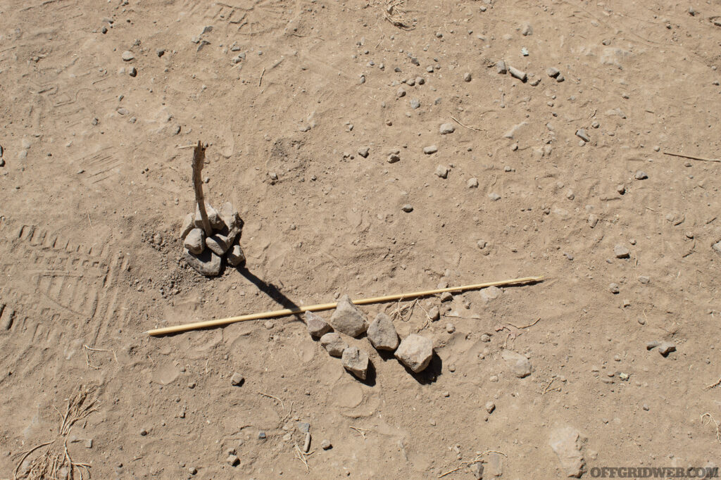
Above: After about 10-15 minutes, you can mark where the shadow has moved. By making a straight line across the two points where the shadow was marked, you are effectively identifying the east-west cardinal directions.
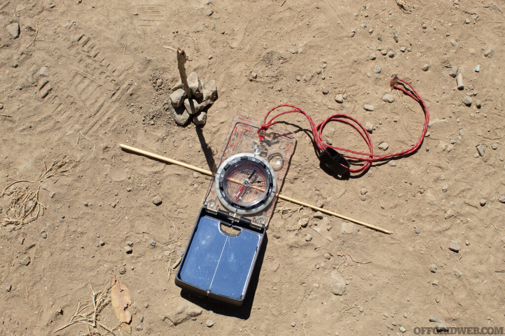
Above: A compass was used to demonstrate how accurate the improvised sundial is. In the photo above, it is pretty spot on.
When humans navigate, be it vegetated wilderness or urban jungle, we create maps in our minds and move relative to the features we recognize. If it’s a trail in the Ozarks, we might use a particularly tall hill to associate where we are in relation to the land around us. In downtown Chicago, we may look for a familiar skyscraper. Navigating in this way is known as terrain association and it is another beneficial way to get around without having to look at a map or shoot an azimuth with a compass. Identify landforms and compare them with your earlier map reconnaissance. Keep your eyes open for watercourses, as they often lead to human settlements.
In our earlier example of walking off the trail for a bathroom break, we can create our own trail markers to find our way back. This method could come in in many forms and are limited only be the imagination. For example, stacking stones or sticks in a particular way periodically would be useful landmarks to find your way back. Brightly colored paracord or marking ribbon, sometimes called flagging, tied at eye-level as you make your way into the vegetation would easily help you return to the trail.
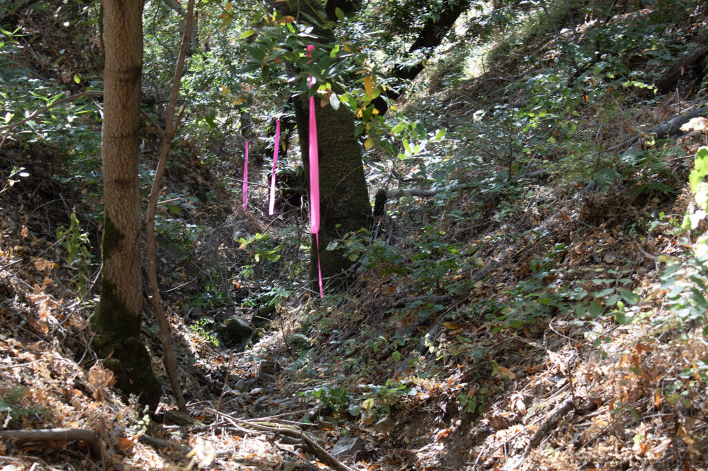
Above: Use long tails and tie off at eye level when marking a trail with flagging, this will make it easier to identify in thick vegetation. If you can line up three in a row, a relatively straight line can be made, which is helpful for maintaining an accurate direction of travel.
Be careful if you use the flagging method to establish a long-term route, such as an off-trail camping location. Inquisitive animals like deer and raccoons will sometimes unintentionally remove these trail markers out of curiosity. To prevent this from happening, make tight knots and leave long tails, about arms-length, to maximize your chances of picking up the route you created. If creating artificial trail markings is impractical, we can look for our way back to safety by using something that all living creatures leave behind: Tracks.
Tracking Skills for Self-Recovery
Navigation mastery typically involves the employment of maps and other devices. Nonetheless, running out of batteries or finding yourself stranded somewhere and with no connection is far from being a remote possibility. This is when your tracking/backtracking skills can be put into use. Tracking yourself in unknown places requires a high level of expertise, along with commitment, dedication, focus and bravery. To many, the skill of tracking can seem primordial, however, it is an art which has been successfully handed down through various means over time to the present. Since the principles of tracking are as old as humanity itself, the skill has maintained itself as a powerful survival tool.
Tracking can be defined as the ability of locating, reading, interpreting, and following animals and/or men by the tracks they left. Simply put, the ground and the entire environment you are in, can provide us all the information we need to get out from a tough situation.
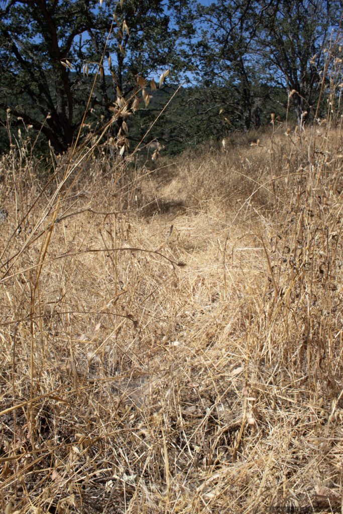
Above: Running through the center of this photo is a path where someone has walked through previously. Identifying disturbed vegetation can help you find your way back to a trail or previous starting point.
Trackers are not a special breed of person. They don't tap into fantastical magic, and they are not guided by any supernatural force when they inspect the ground to gain important information. They just rely on simple facts, and on science. Their task is to read the ground, interpret what they see and follow the tracks which are of their interest. They collect clues, which is precious data for them, and put all the pieces together. By reading tracks in this manner, they can disclose how many persons passed on a specific trail, how old the tracks are, if they were carrying gear, if they were man or woman, what was happening at the time, and so on. There is an unbelievable amount of information in each track.
Getting lost in the woods can be handled through the application of the art of tracking and requires no tools beyond your own physical senses, observational skills and intuition. Because of this, it can be employed in any situation, in any weather condition, at any time of day. Reading the tracks of your own, and other people’s footsteps on the ground, for example, can potentially lead you to a safe place, such as a parking area, the next road, and so on.
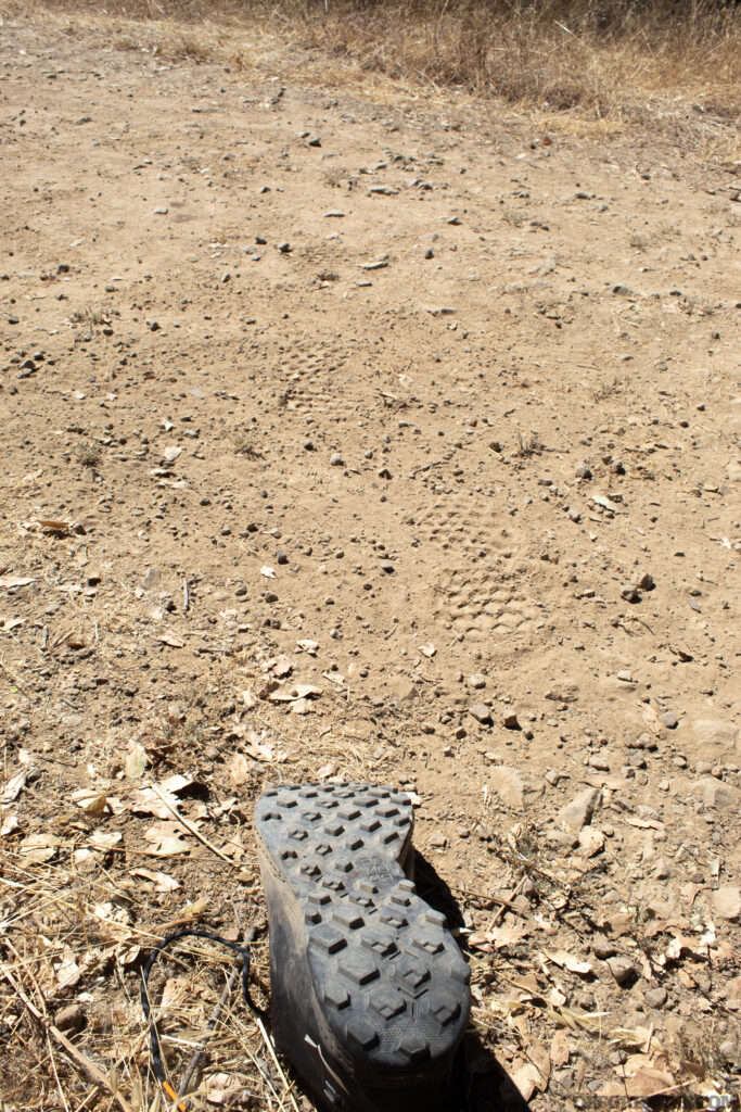
Above: Knowing the tread pattern of your footwear can help you track your own footsteps back to where you came from.
Being able to read a track easily depends on both the land being traveled, and the individual skill of the tracker. A beginner may only be able to detect their footsteps on ground that is easily disturbed, such as mud or wet sand. An experienced tracker may be able to follow footsteps across exposed bedrock. Using tracking as a self-recovery tool will only be as effective as the tracker, and this skill can only be developed by getting out there and observing the signs you leave behind.
If you find yourself on a soft or humid terrain, you might be able to backtrack yourself by checking the design of the soles of your shoes. This must be done in a very accurate way, as a miss-interpretation could easily lead you into following the tracks of those who passed before you. Running into mistakes can turn into increased distress, especially when you feel physical and mental fatigue.
Observations In the Field
Feeling lost is a harrowing experience, but it can be mitigated, and even resolved with the power of observation. Situational awareness isn’t just looking for immediate threats, its also understanding your position on the globe, and how surrounding features could help or hinder you recover efforts. Observation can allow us to collect data on several details of utter importance connected to safety, such as:
- distance to our destination
- the type of environment we are in
- the area we are crossing
- evolving weather conditions
- probability of finding a safe place to spend the night
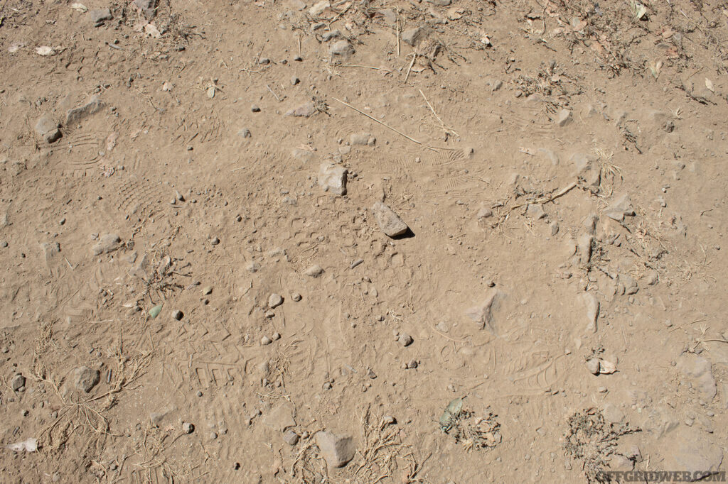
Above: There are multiple tread patterns in this photo, but knowing which one is yours will help you follow the right trail. Tracking in the dust like this can be more difficult than tracking in a medium that is moist.
In terms of tracking, we do not have to look explicitly for footprints, but there are many signs that could leave “bread-crumbs” helping us find our way back. Every detail counts when it comes to understanding our location. Additionally, observed and analyzed information can play an important role in determining our safety if we find ourselves stranded:
- signs of urbanization
- presences of roads
- presence of vehicles
- flora and fauna
- detection of any sound we can immediately recognize as man-made
- any trace of recent or old passage of people and/or animals
Navigating by Night
Night navigation is generally risky due to limited visibility, increased activity of predatory animals, and should be avoided if possible. But the darkness of night is an opportunity to increase your chances of being rescued. At night, it's easier to signal for help due to the contrast of light and darkness. Rescuers will be able to spot signal fires or blinking distress signals from a much greater distance than they would normally be able to during the day. That being said, if stopping for the night is not an option, the moon and stars can be helpful orienteering tools. The moon rises in the east and sets in the west, just like the sun. As for stars, the Big Dipper constellation in the northern hemisphere and Southern Cross constellation in the southern hemisphere can give you another indication of where north and south are located.

Above: There are several signs on the landscape in this photo that can be used to navigate. City lights in the distance, light pollution over the horizon, and the big dipper in the sky.
Light and noise pollution can indicate nearby human presence but be cautious as these could also be misleading. The roar of ocean surf, or water tumbling over a fall might sound like a busy highway or airport. Light reflecting off the clouds in the sky from a large city may be hundreds of miles away. But, since the darkness will hide any terrain associating reference points, lost persons will almost always wander in circles without something to guide them.
Navigation Myths
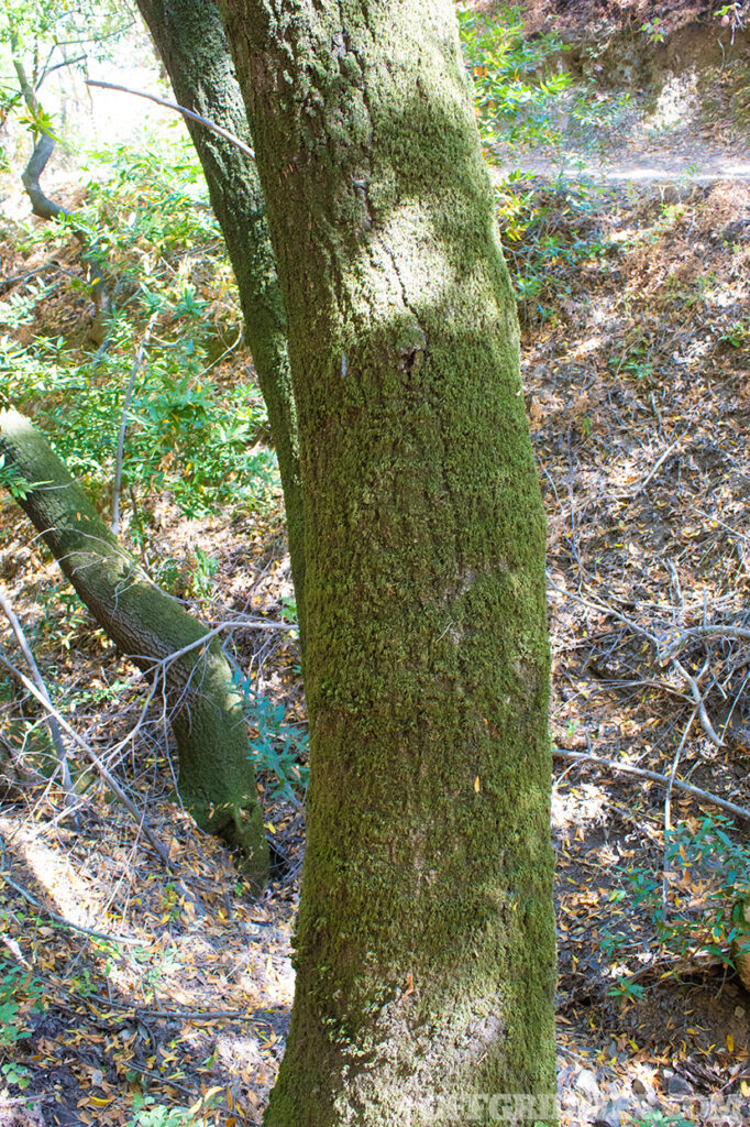
As with any subject, wilderness navigation isn't free from myths. You might've heard that moss grows on the north side of trees, which isn't universally true. Similarly, relying solely on celestial bodies isn't wise, as weather conditions can make them invisible.
A common myth is that pace count will tell you the exact distance traveled. However, different terrains and individual strides make this a rough estimation at best. Unless you know your pace count perfectly in every weather condition or terrain type you encounter, it will only give you a rough estimate at best. It is much more effective to travel in a straight line towards an emergency bearing.
Finally, there's a belief that lost people move in circles or favor their dominant side. This isn't universally applicable and greatly depends on the individual's state of mind and physical condition, topography, and time of day.
Mastering navigation in the wilderness without relying on tools is an invaluable survival skill. By planning ahead, understanding your body's response to stress, using nature as your guide, and avoiding the traps navigation myths might try to spring, you'll be better prepared to face any wilderness adventure that comes your way.
Related Posts
- Celestial Navigation
- Backcountry Cell Phone Land Navigation
- Survival Lessons Learned from the Nation's Best Trackers
- Video: The Basics of Solar & Lunar Navigation
Related Posts
“HOW NOT TO DIE”: Laura Zerra's Guide to Wilderness SurvivalFollow renowned survivalist Laura Zerra as she discusses her most important advice on how to stay alive when things take a turn for the worst.

Journey Back in Time: Embracing Ancient Hunting TechniquesPrimitive skills instructor Phillip Liebel delves into the ancestral Puebloan culture and their ancient hunting techniques.
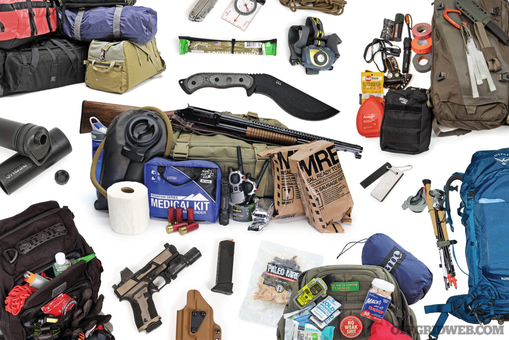
Bug Out Bag List of EssentialsThis bug out bag list of essential gear can help you and your family become better prepared for a variety of emergency situations.

Survival Botany: Six Lifesaving Plant SpeciesSurvival botany can save your life in an emergency. Here we cover six of the most common edible plants in North America.
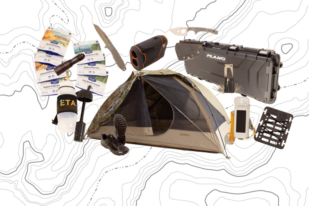
Gear Up: New Survival Gear For August 2023A quick look at some of the latest survival and preparedness gear.

Top Countries to Survive the ApocalypseWe explore two sources discussing which countries would be best for surviving a catastrophic disaster, and why you should avoid others.

“Survivalist” Manhunt: Craig Caudill's Insights Of a Fugitive on the RunSurvival expert Craig Caudill provides insights regarding the Pennsylvania manhunt for escaped inmate, Michael Burham.

Run to the Hills: What to Consider Before Moving to the CountryEscaping the chaos of the city by moving to the country is an appealing prospect for many, but there are several important things to consider.

Learn How To Build Your Own ForgeCreate what you need, when you need it, by learning the basics of how to build your own blacksmithing forge.
The post Raw Wilderness Navigation: Navigating Without Tools appeared first on RECOIL OFFGRID.
By: Patrick Diedrich
Title: Raw Wilderness Navigation: Navigating Without Tools
Sourced From: www.offgridweb.com/preparation/raw-wilderness-navigation-navigating-without-tools/
Published Date: Thu, 10 Aug 2023 11:00:34 +0000
-------------------------------------------------------------------------
 CampingSurvivalistHuntingFishingExploringHikingPrivacy PolicyTerms And Conditions
