Death Valley National Park is one of the largest and most remote places in the country. At approximately 3 million acres, Death Valley is the largest national park in the contiguous United States. About 93% of this park is designated wilderness or backcountry, and recently, I spent three days trekking through this desert wilderness.
I work as a backcountry guide, and about a year ago, I volunteered to be on a team that would take two guests from 282 feet below sea level at Badwater Basin—the lowest point in the U.S.—up to above 11,000 feet at the top of Telescope Peak. This trek is known to be “Everest-like,” mimicking the elevation gain between Everest Base Camp and its summit.
Our original plan was to go out and hike the entire route over three days and two nights without our guests, so that we could lay eyes on the whole route and get the proper trail beta for them. We would hike it as a point-to-point, leaving a car at Shorty’s Well and another at Wildrose Campground. This scout trip was to take place in November 2023, with the full expedition with guests happening in 2024. A large portion of this route is off-trail wilderness travel, so we wanted to go out and scout the route so that we could get them the information they need to prepare for backcountry camping in Death Valley. However, Hurricane Hilary had other plans.
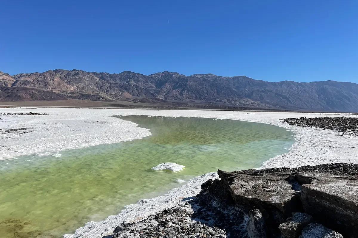
Image by Halle Homel
The Backup Plan
In August 2023, a rare west coast hurricane caused major flash flooding in the park. This led to most of the backcountry roads remaining closed and washed out at the time of our scheduled scouting mission. This meant we couldn’t drive in to the point we’d be starting with guests. Because of this, we had a few options: trek across the wet basin to Shorty’s Well, or walk the 10-mile-long Westside Road.
Trekking across the basin would’ve been about 5 miles shorter each way, however, the basin is filled with a rare lake due to the same flooding. When Badwater Basin gets wet, the layer of mud under the salt turns thin and squishy and collapses quickly when stepped on. This meant that our best option was going to be to add 20 miles to our trek and walk Westside Road.
This obviously wasn’t ideal, and it prompted us to make the decision to only hike in as far as our water source at Hanaupah Spring. If time allowed, we would slack pack up a little higher on day two to lay eyes on the ridge. We’d save the rest for a second scouting mission in the spring.
Beyond the Locked Gate
Our first day started at sunrise from the start of Westside Road, where the park had locked the gate, marking it as a road closure. While you normally don’t need backcountry permits for this route, we did pick one up from the visitor center the day before to avoid anyone worrying about our van being parked at the road junction for three days. For our trip with guests, we will be carrying a commercial use permit.
The thing about Death Valley is, this park is huge—and dry. Between myself and my two teammates, we carried 15 liters of water into the backcountry that day. We each needed to have about 5 liters per 20 miles of trekking to make up for the heat we’d experience at the lower elevations. It was about 85 degrees Fahrenheit at the heat of the day, and with two of us traveling from the Pacific Northwest where we are used to cooler temperatures, we knew the heat would be no joke.
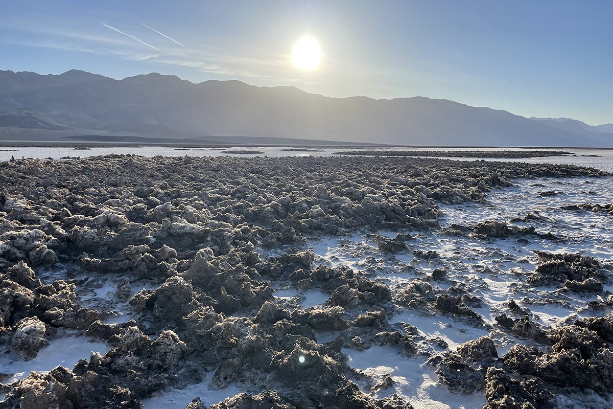
Image by Halle Homel
The beginning of our trek was easy enough—flat for the most part, on the road, across the basin. It was quiet and exposed, and the terrain changed quickly from salt covered and hard to sandy, and then to loose rocks. There was even a small pond we had to skirt around, hoping to not sink in the thin, salty mud.
The easy road walking ended at mile 10 when we finally reached the junction of Shorty’s Well and Hanaupah Canyon. We would walk into the canyon, gaining an easy 3,000 feet over the next 10 miles. The grade itself wasn’t steep, but the ground was quickly turning into loose rocks and washed out sections. About 4 miles from the junction, we saw a white truck carrying a survey crew. They were quick to tell us that the road was closed, assuming we’d driven to Shorty’s Well. We explained that we were actually approaching mile 15 and that we’d walked Westside Road. We were then warned that the terrain would get worse the further up Hanaupah Canyon we walked.
And they were right, the washed out stuff slowly turned into a looser, alluvial fan that stretched out ahead of us. We were still ascending into the canyon and had about 5 miles remaining until we reached the place where the spring was supposed to be . . . or so we thought.
The Weary Walk to Water
Around 4:30 PM, the sun dipped below Telescope and the other mountains ahead of us. We layered up, put on our headlamps, and kept going. We had to make it to water.
At mile 20, we stopped and checked our maps, quickly realizing that water was likely another mile and a half up the canyon. We were disappointed and feeling ready to set up camp and go to sleep. Hanaupah Spring isn’t reliable, but since we got permits and spoke to a ranger before coming out here, we knew there would be water at some point.
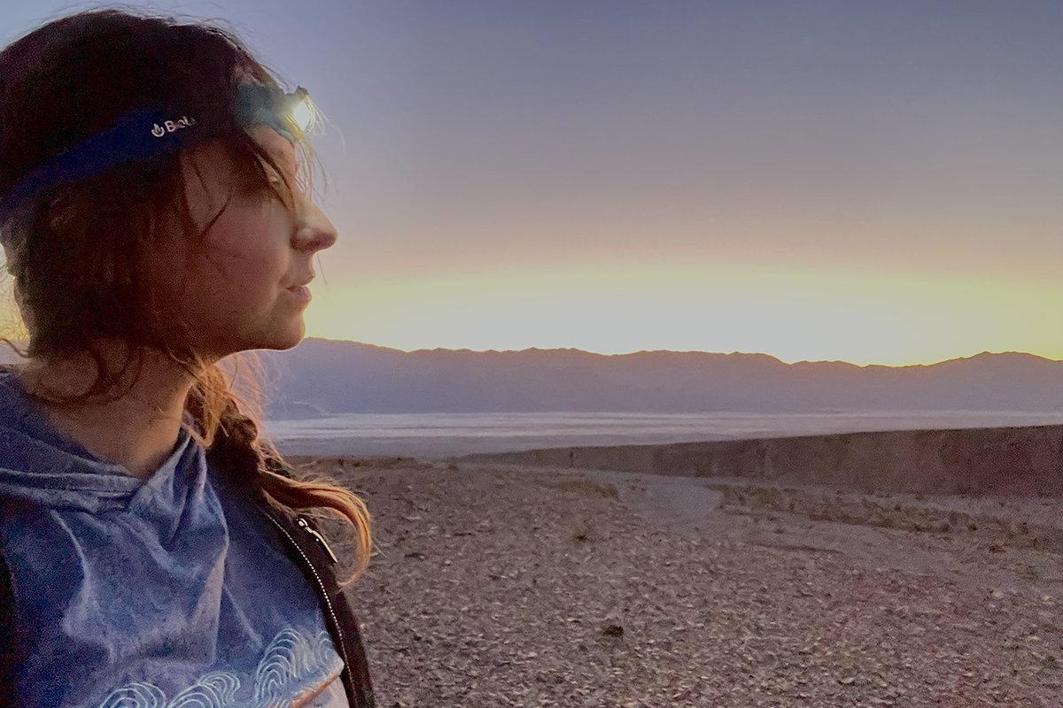
Image by Halle Homel
We had a mile and a half left to walk in the dark on uneven ground. Eventually, one of my teammates went ahead to see if he could find the water. After about 30 more minutes of walking, we heard him shout, “I found water!” This was a relief. We were all running low on the water we’d packed out for this stretch, and we were tired of walking.
An Excruciating Curveball
I stepped up on a big rock to make it over to where my teammate was searching for campsites, but the rock collapsed under me. I fell hard on my left hand, and my wrist was in excruciating pain. I sat for a minute, my team surrounding me, before I got up, knowing that we had to set up camp, and also, that I wouldn’t be joining them to scout the ridgeline the next day if I couldn’t use both of my trekking poles. I could tell that my wrist was in bad shape and putting weight on it would be a bad call.
We made dinner in the dark using filtered spring water and my teammates looked at my hand. It didn’t seem broken at the time (spoiler alert, it was), so I had one of them help me wrap it in an ace bandage for compression, and I took some ibuprofen to help with the swelling. We are all Wilderness First Responders, which means we all knew what to do in this situation. Had we not had this experience, this might have put an early end to our trip.
In the morning, I stayed at camp while my team ascended another 3,000 feet up the ridge to get eyes on the next part of our route, which would also be off-trail travel. They messaged me via satellite phone around 10 AM, telling me that they’d gotten the information we needed and were heading down.
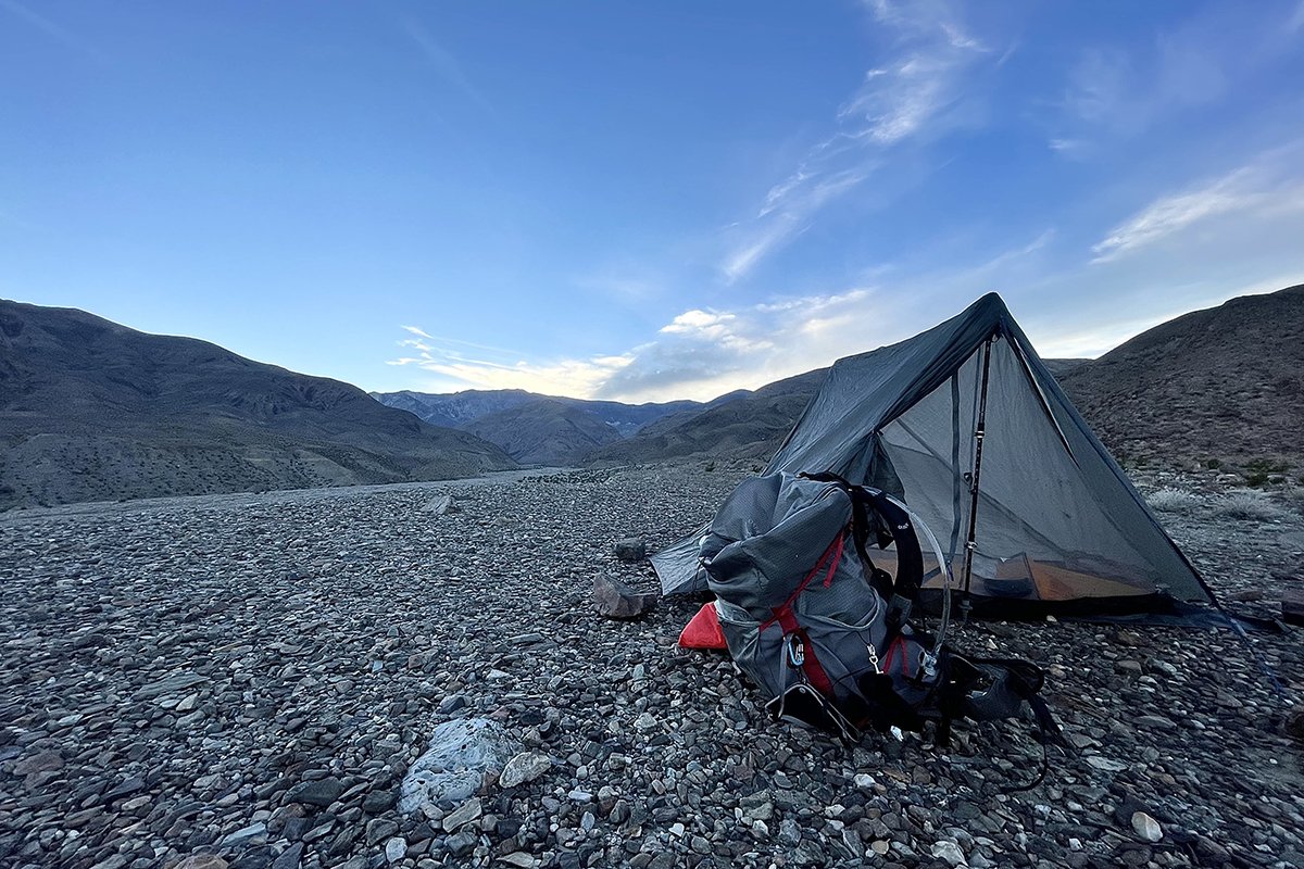
Image by Halle Homel
We made the collective decision to filter 5 liters of water each and hike out of the alluvial fan that day. That way, we could take our time on this slow 6 miles and have an easy 15 miles on day three. This was partially to accommodate the fact that I could only use one trekking pole, but also partially due to us all being tired and wanting an easier couple days hiking out.
We discovered that the hike out of the alluvial fan was much easier in the daylight and reached better ground for camping within a few hours. We set up camp and had time to eat dinner while watching the sunset over Dante’s View across the basin from us. We knew that we were likely the only people on our side of the basin looking out toward the main road and watched headlights as cars drove out after dark.
The Hot Hike out
On the third day, we packed up camp and started our 15 mile hike out, taking bets on how long it would take us. The miles were cruisey, either downhill or flat, but the sun was hot and unrelenting. We stopped every 5 miles, drinking water and lightening our packs in the process. My wrist hurt, but the way it was wrapped kept it stable while still allowing me to use my fingers for opening water bottles and food.
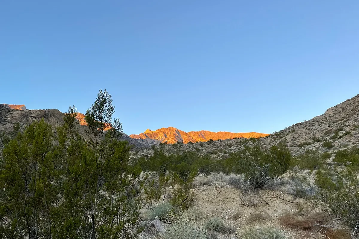
Image by Halle Homel
We finished our hike out around 12:30 PM, making it the fastest 15 miles I’d ever hiked. My teammates both had blisters and bruises, and the wrap we’d done on my hand was working as well as it could work. We’d cruised through the flat parts, sunk in the loose mud around the salt flat pond, and slowed a bit on one last uphill section toward our van. At our “trailhead,” we were greeted by four tourists who had been worried about us due to seeing our van there for three days. We were super grateful for their concern and excited to tell someone about our adventure while we took off our hiking shoes and dropped our packs.
The Death Valley backcountry is beautiful and harsh, and despite injuries, blisters, and facing the unexpected, I look forward to returning next year for the main event, going from Basin to summit.
The post My Death Valley Backcountry Camping Trek Did Not Go As Planned appeared first on Outdoors with Bear Grylls.
https://outdoors.com/death-valley-backcountry-camping-trek-did-not-go-as-planned/
 CampingSurvivalistHuntingFishingExploringHikingPrivacy PolicyTerms And Conditions
