An excellent overnight or multi-day loop through one of the most scenic areas in Virginia. The route leads hikers to the summit of Mount Rogers, the highest peak in the state, beside large rock outcroppings offering expansive ridgeline views, and through lush mountain meadows where wild ponies roam freely. The loop also features exceptional backcountry camping options, providing mountain panoramas sure to leave lasting memories for those who call Mount Rogers and the Grayson Highlands home for the night.
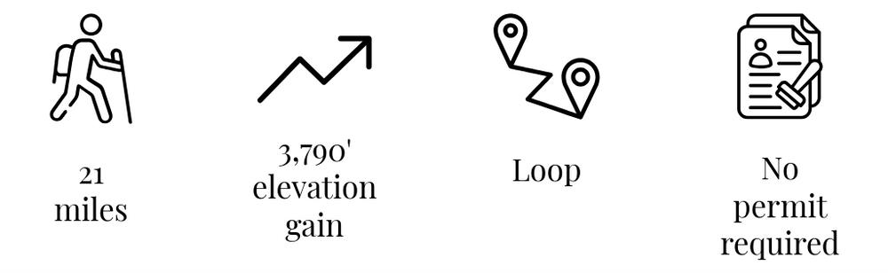
Trailhead elevation 3,753'
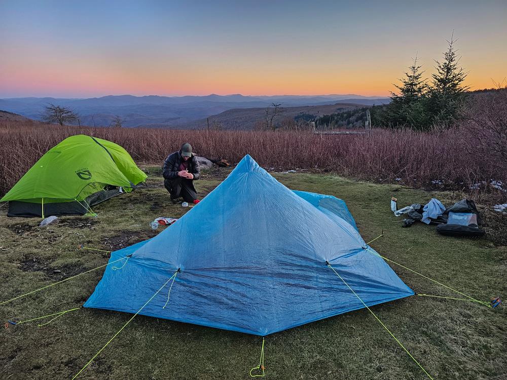
Water Thomas Knob Shelter and three streams after the shelter
Don't miss Camping near the Thomas Knob Shelter
Backpacking the Mount Rogers & Grayson Highlands Loop
The loop can be started from a number of trailheads, the two most common being the Overnight Backpacker's Lot in Grayson Highlands State Park located at the southern end of the loop, and the Mount Rogers Trailhead in Lewis Fork Wilderness at the northern end of the loop. The route detailed below begins from the Mount Rogers Trailhead, hiking counterclockwise. Due to an abundance of intersecting trails along the route, having a downloaded map of the loop is strongly encouraged.
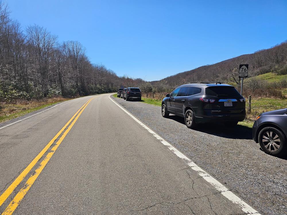
Free roadside parking for the Mount Rogers Trailhead can be found along VA-603 at coordinates 36.6893579, -81.5320954. The gravel lot can accommodate around ten vehicles. In the event that these spaces are take, additional pay for parking can be found 0.4 miles west at the Grindstone Campground.
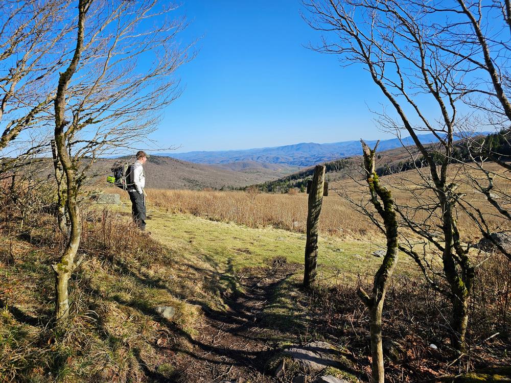
From the trailhead, the route initially follows the blue-blazed Mount Rogers Trail as it ascends through the Lewis Fork Wilderness and the northern slope of Mount Rogers. 0.8 miles after joining the Appalachian Trail at the 4.2-mile mark, the loop reaches its first expansive view. Here, hikers will have views of Balsam Mountain to the east, Bluff Mountain to the southeast, and a slew of other peaks in the distance.
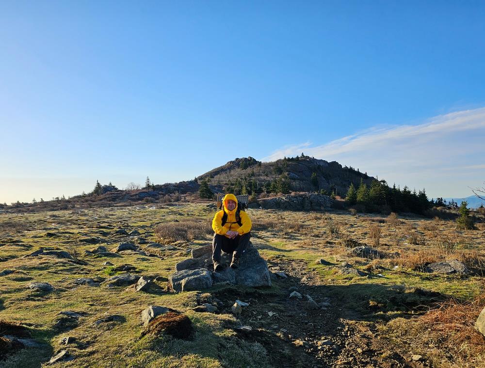
A mile further along, the AT intersects with the Mount Rogers Spur Trail. While the summit of Mount Rogers itself doesn't offer expansive views, those aiming for Virginia's highest peak can hike up the spur an additional 0.5 miles, ascending 300 feet to reach it. At the top, a large boulder marked by a USGS survey benchmark indicates the summit.
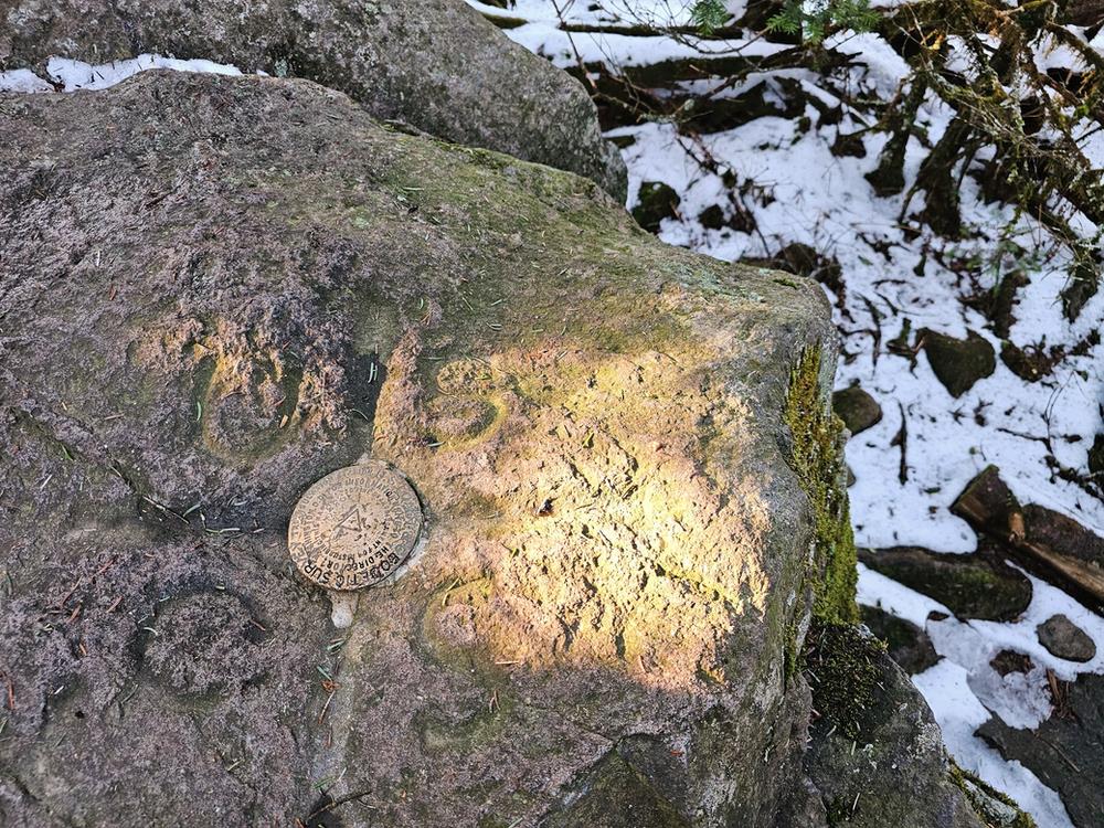
Once known as Elliott's Knob, the mountain was renamed Mount Rogers in 1883 in honor of William Barton Rogers, Virginia's first State Geologist and founder of MIT.
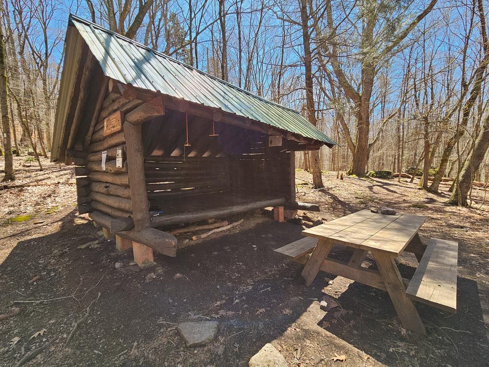
Upon descending from the summit and rejoining the AT, the route advances eastward, tracing the perimeter of the Lewis Fork Wilderness boundary. Around the 7.5-mile mark, hikers encounter the Thomas Knob Shelter, a large two-story shelter capable of accommodating a dozen or more people.
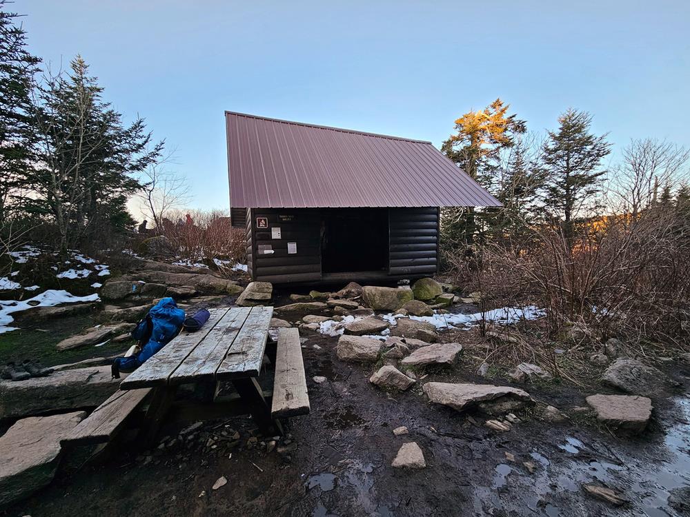
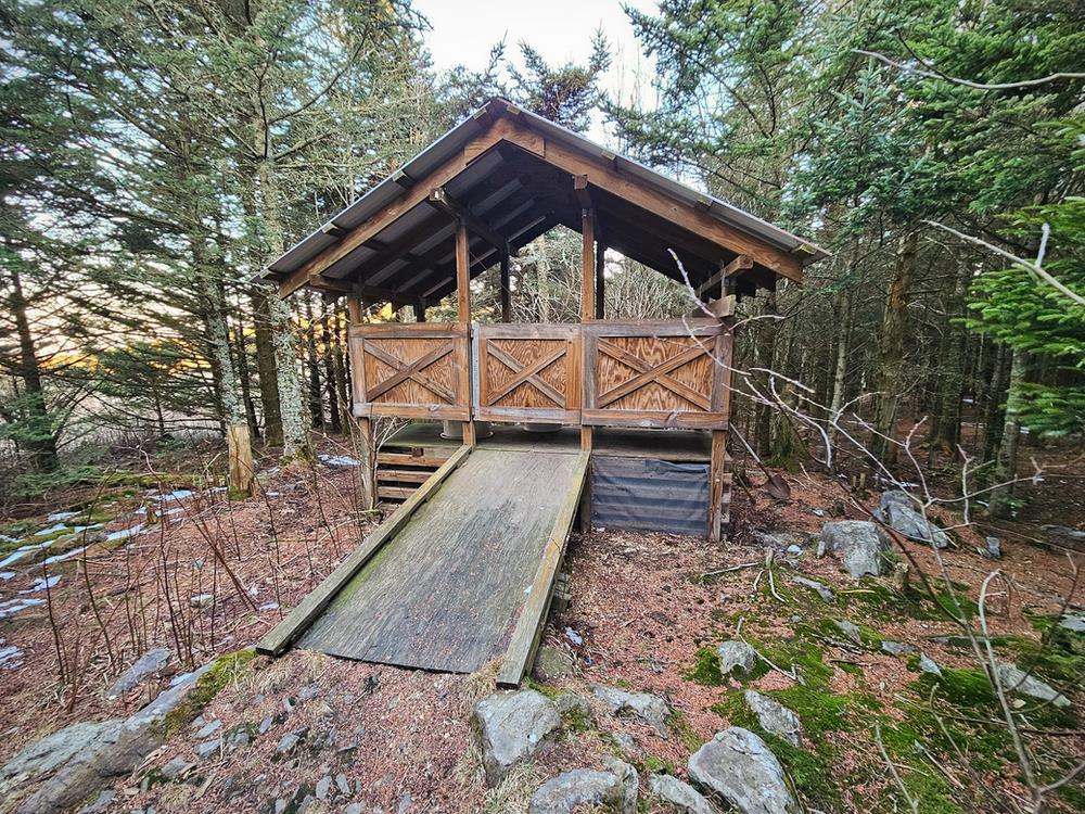
A bear box and a dependable year-round water source can be found a few hundred feet behind the shelter. Adjacent to the shelter, among the pines, is a sheltered privy.
Flanking the shelter, hikers will find numerous tent sites, with three available before it and at least two dozen beyond. Nearly all these sites provide exceptional south-facing mountain views, but tend to experience high winds throughout the year.
Those starting from VA-603 and hiking to the summit of Mount Rogers and Thomas Knob Shelter can anticipate a day covering 7.5 miles with an elevation gain of 2,300 feet.
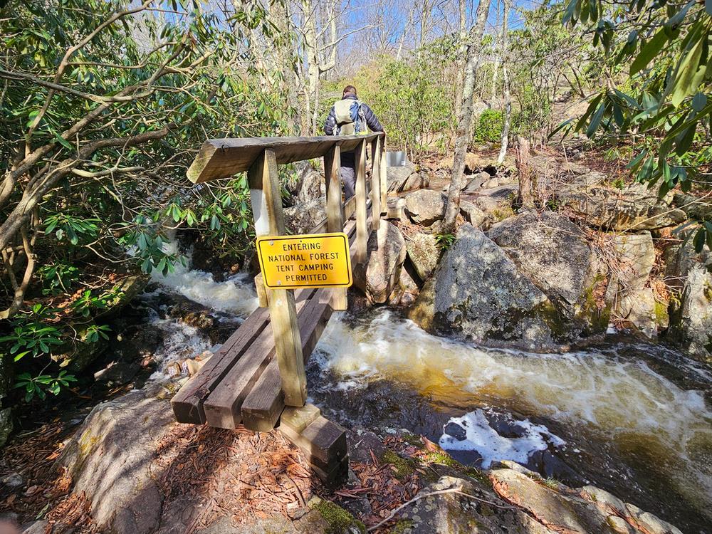
Within 0.75-miles from the shelter, the AT leads into Grayson Highlands State Park where backcountry camping is prohibited. Soon after entering the park boundary, hikers will catch a distant glimpse of Wilburn Ridge, Virginia's second tallest peak at 5,542-feet.
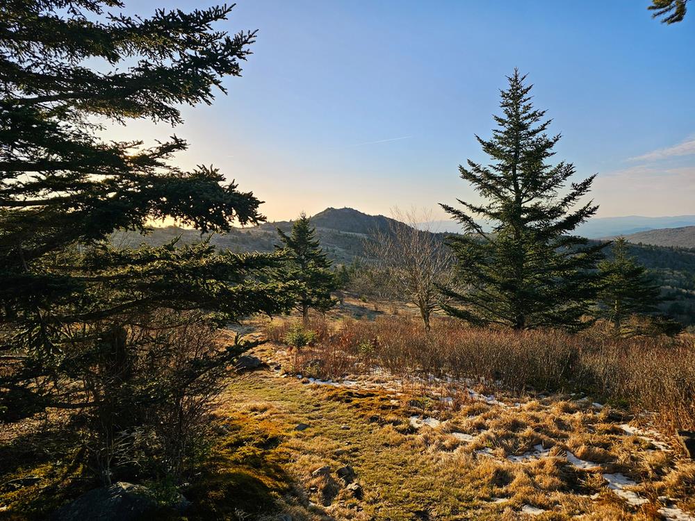
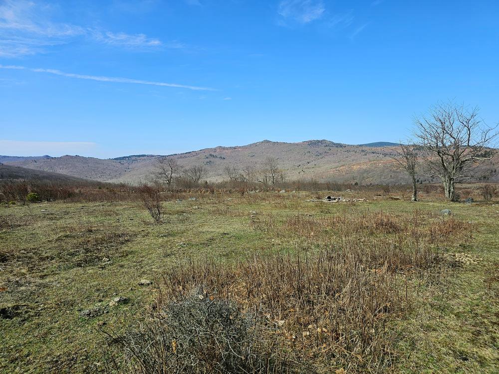
Continuing on, the AT crosses a vast open meadow speckled with spruce trees and small boulders just before ascending the rocky slope of Wilburn Ridge.
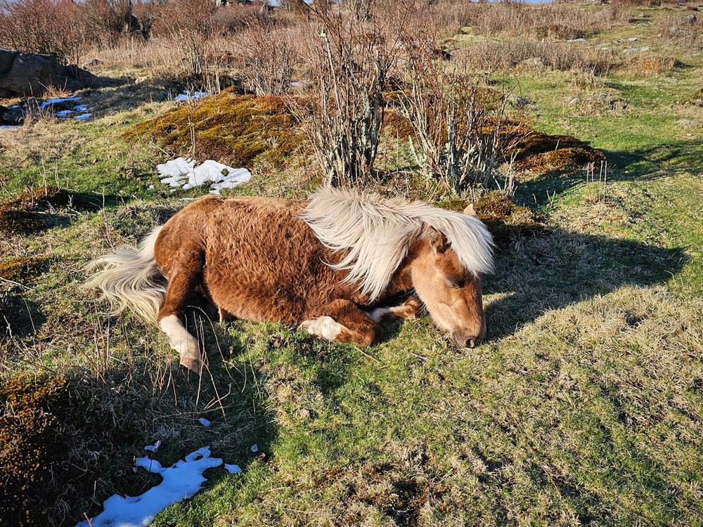
Once atop the ridge, hikers might consider taking a moment to take in the views of a seemingly endless sea of peaks on the horizon and scan the eastern slope for the wild ponies often seen grazing along it. The ponies are known for their gentle demeanor, making it generally safe to approach for a closer look during the descent.
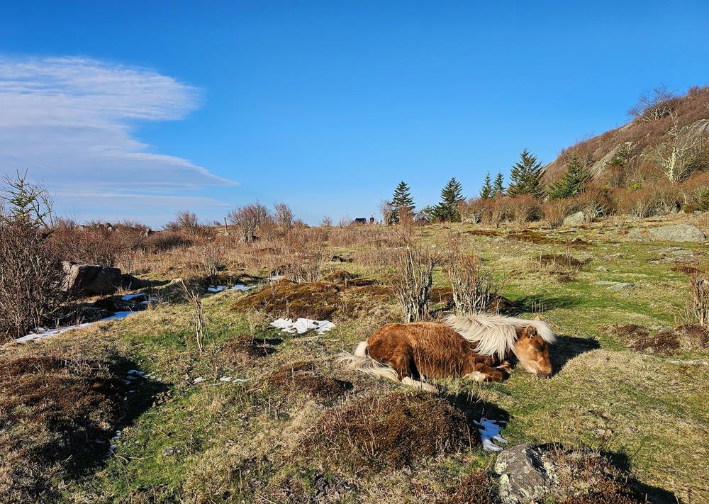
Prior to its designation as a state park in 1965, the Grayson Highlands were once sprawling farmland, frequented by cattle and a small population of ponies. However, with the park's establishment, the lush grassy balds were left unattended. Recognizing the need to preserve the landscape, a herd of twenty ponies were introduced to the area in 1974. The introduction led to the formation of the Wilburn Ridge Pony Association in 1975, a nonprofit that safeguards the free-roaming ponies that number around 100 today.
After Wilburn Ridge, the loop meanders past several sizable rock outcroppings and open meadows before descending to Quebec Run, the first dependable stream encountered after the shelter, at approximately the 12-mile mark. Water from Quebec Run, as well as subsequent streams along the loop, should be filtered for drinking.
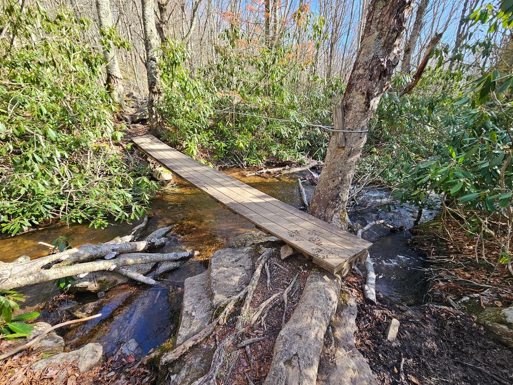
Over the next three miles, the trail predominantly winds through wooded terrain, passing the Wise Shelter and sheltered privy at around the 13-mile mark, and two additional reliable streams crossed via footbridge at approximately 13.1 and 13.3 miles. The bear box for the Wise Shelter can be found 500 feet beyond the shelter on the far side of Big Wilson Creek at 13.1 miles.
Within 0.25 miles of crossing over Wilson Creek at 13.3 miles, hikers will find a large camping area along the right side of the trail capable of accommodating around a half dozen tents. By the 13.7-mile point, the AT enters Little Wilson Creek Wilderness, ascending to an open plateau offering expansive views of Wilburn Ridge, Pine Mountain, Mount Rogers, and various other peaks in the distance. Along the plateau, hikers will find numerous backcountry campsites. Those interested in making the trip into a two night, three day hike might consider one of these sites.
Around the 16-mile mark, hikers will arrive at the Scales Campground, a large fenced field equipped with an outhouse and bear box. However, there is no water available at this site.
Continuing three miles more, hikers will reach the Old Orchard Shelter, a sheltered privy, two bear boxes, and a large field suitable for around ten tents. A dependable spring lies within a short distance from the Old Orchard Shelter.
After the Old Orchard Shelter, hikers have several options to complete the loop. Following any combination of the AT and Old Orchard Trail will lead to VA-603, where hikers can choose to follow the Fairwood Valley Trail or walk along VA-603 back to the trailhead. Those who have chosen to follow the loop as described can anticipate day two to cover around 13.5 miles with roughly 1,500 feet in elevation gain.
Those planning to backpack the loop should be aware that the 5 miles leading up to the Thomas Knob Shelter and the last 5.5 miles are entirely forested with no expansive view. However, the core of the loop, spanning from the Thomas Knob Shelter through Wilburn Ridge, offers remarkable beauty that more than compensates for the lack of views in those sections. Starting from the Mount Rogers Trailhead allows hikers to avoid parking in the Overnight Backpacker's Parking Lot in Grayson Highlands State Park, which requires a paid reservation. Hiking the loop counterclockwise from the Mount Rogers Trailhead provides far more scenic views that hiking in a clockwise direction, especially near Wilburn Ridge.
https://www.greatamericanhikes.com/post/backpack-the-mount-rogers-grayson-highlands-loop
 CampingSurvivalistHuntingFishingExploringHikingPrivacy PolicyTerms And Conditions