As the capital of Colorado, Denver is a vibrant city with quick access to numerous trails. From downtown Denver, you can drive an hour or less and find yourself submerged in the evergreen trees and the Rocky Mountains, making it a convenient destination for hiking.
When I lived in Colorado for six years, I spent many weekends and summers exploring the best hikes in Denver with friends and my husband. One of my favorite things to do was to go for a day hike and then drive into the city to grab drinks and food.
Whether you’re visiting Denver for work, fun, or have time to kill during a layover at Denver International Airport, there are hikes for people of all abilities to enjoy. I’ve included a mix of distances, difficulty levels, and elevation gains so you can pick the best trail for you.
Although I have not explored ALL the trails in Denver (there are hundreds), these are six of the best trails I’ve hiked during the summer season. I hope this guide helps you decide which trails to tackle on your next trip to Denver.
Download my FREE Outdoor Trip Planning Toolkit
Enter your email to get access to printable PDF packing checklists, itineraries, and more.
Best Day Hikes in Denver
Before you arrive in Mile High City, it is important to consider which trail you want to explore so you know what to expect.
All of the hikes on this list are accessible via paved roads. None of them requires a vehicle with 4×4 or high clearance to get to the trailhead (if the roads are clear of snow).
If you want to bring your canine companion, all the hikes on this list are also dog-friendly. Without further ado, here are 6 of the best hikes in Denver.
1. Red Rocks Trading Post Trail
Trail Basics
- Distance: 1.5 miles
- Type: Loop
- Elevation Gain: 357 feet
- Time: 45 minutes
- Difficulty: Moderate
- Drive time from Denver: 20 minutes
- Map: AllTrails
Out of all of the hikes on this list, the Red Rocks Trading Post Trail is the closest drive from downtown Denver, making it an ideal hike if you are in a time crunch. At 1.5 miles, this is a moderate, family-friendly hike.
Many people have heard of the Red Rocks concert venue. If you don’t have tickets to a show, this trail is a great way to get a taste of the iconic red rocks and explore the famous venue.
This loop trail starts and ends at the Trading Post, a historical Pueblo Revival building that includes the Colorado Music Hall of Fame museum, memorabilia, and souvenirs. I highly recommend checking it out at the end of your hike to cool down in the air-conditioning or warm up in the heat (depending on the time of year you visit).
I hiked this trail in September with my husband and cattle dog. There are several sets of stairs throughout the trail, but the dirt trail is relatively flat and easy, and I wore hiking sandals.
I enjoyed stopping for photos of the towering rocks that surround the trail. These interesting rock formations make you feel like you’re exploring Mars!
Something to note about this trail is that there is little to no shade coverage. If you hike on a sunny day, bring sun protection and plenty of water. There are restrooms and water available at the Trading Post.
There are ways to lengthen the hike and add on connecting trails if you’re looking for a longer day hike, including the Will Call trail or Mt. Vernon Creek trail.
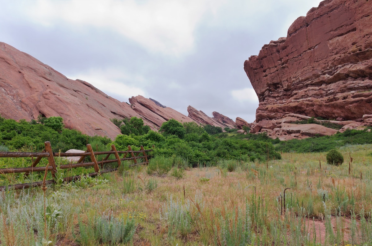
With the stunning orange rock formations along the trail, you may feel like you’re on Mars
2. Saint Mary’s Glacier
Trail Basics
- Distance: 1.6 miles
- Type: Out-and-back
- Elevation Gain: 528 feet
- Time: 1 hour 15 minutes
- Difficulty: Moderate
- Drive time from Denver: 1 hour
- Map: AllTrails
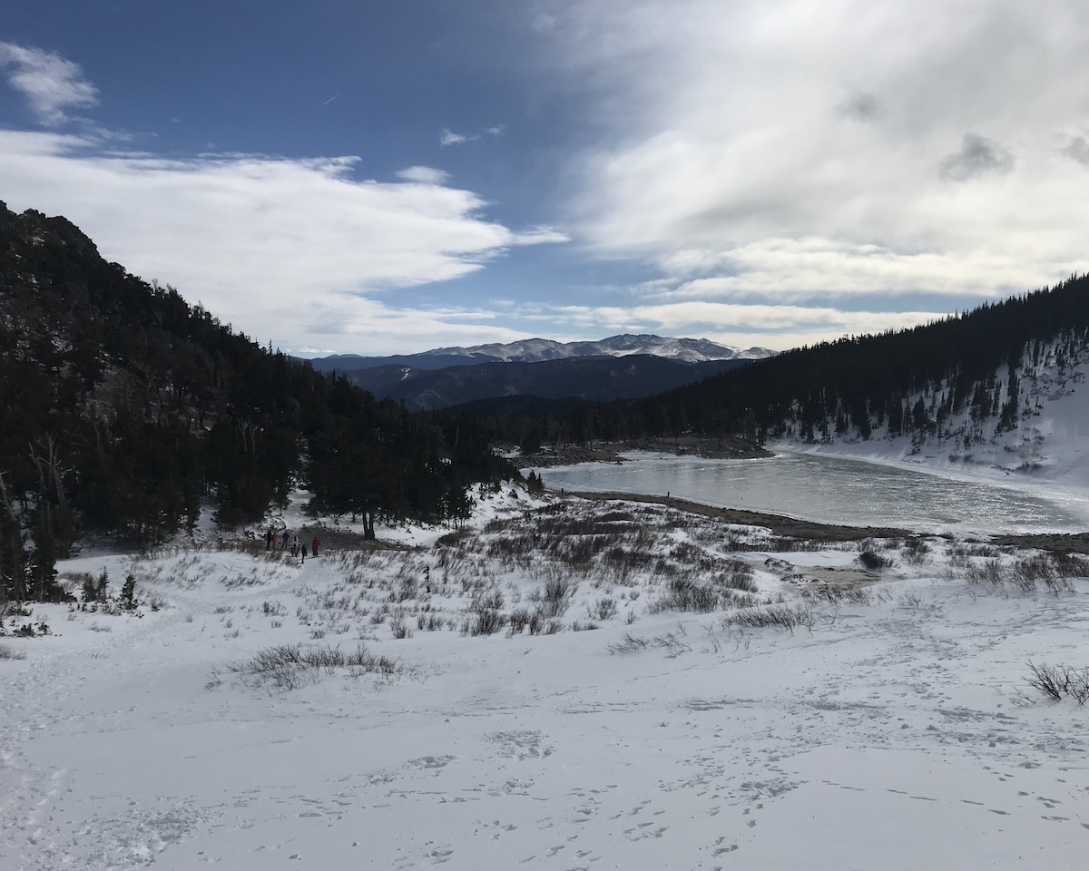
Have you ever hiked to a glacier? If not, here’s your chance. Saint Mary’s Glacier is a quick, 1.6-mile hike and only an hour’s drive from Denver.
Although this hike is short, it can be challenging for those not acclimated to the high elevation. The trail starts at 10,388 feet of elevation, so you may struggle to breathe and maintain your usual pace on the trail.
On your way to Saint Mary’s Lake, you’ll hike in a forest through towering bristlecone pine trees. This section of the trail is a bit challenging as you gain 347 feet of elevation in half a mile.
However, the trail is wide with plenty of places to stop and catch your breath. Once you arrive at the lake, you’ll continue to take the trail to the right and climb another 200 feet over 0.3 miles.
This is where the obvious route disappears, and I recommend downloading the AllTrails map ahead of time to help you navigate. The reward is incredible panoramic views of the Rocky Mountains to the west.
No matter what time of year you complete this hike, you’ll see snow on the glacier. In the summer, you can bring your swimsuit and jump in the lake, but it is freezing glacial water. There are restrooms at the trailhead but no water, so bring your own!
To park at the trailhead, you must pay $20 and display a permit on your windshield. There is no ranger on duty, so you must grab an envelope and put cash inside or write down your credit card information (you drop it into a secured lock box). Bring a pen to write down your license plate number on the envelope.
View of the Rocky Mountains after hiking a short way up the side of Saint Mary’s Glacier
3. Echo Lake to Idaho Springs Reservoir
Trail Basics
- Distance: 4.0 miles
- Type: Out-and-back
- Elevation Gain: 761 feet
- Time: 2 hours
- Difficulty: Moderate
- Drive time from Denver: 55 minutes
- Map: AllTrails
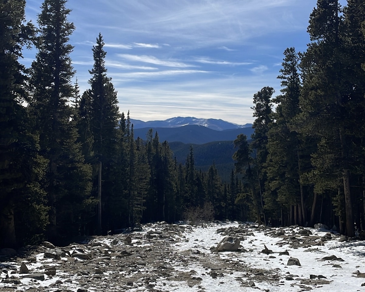
If you love alpine lakes, forests, and mountain views, this hike has it all. The Echo Lake to Idaho Springs Reservoir trail is a 4-mile, out-and-back trail with just the right amount of challenge for a fulfilling day hike.
The trailhead has water, vault toilets, and free parking. As soon as you start hiking on the path, you will see beautiful views of Echo Lake. On a clear day, you can see the reflection of the pine trees and snowy mountain peaks in the blue water.
This trail is above 10,000 feet in elevation for the entire hike, so you may need to take breaks to catch your breath. Thankfully, the dirt path weaves through a forest that offers shade and big rocks to sit on as needed.
The trail is hilly and rocky, so wear grippy hiking boots with good traction and use trekking poles if you have them.
As you approach Idaho Springs Reservoir, there is a steep gravel section. It is a little under 300 feet of gain over a half mile. The trail widens at this section, so you will have plenty of room to take breaks.
Once you reach Idaho Springs Reservoir, you’ll be greeted with stunning views of blue water, pine trees, and mountain views. I recommend finding a spot near the water to enjoy a hiking snack or picnic lunch before heading down.
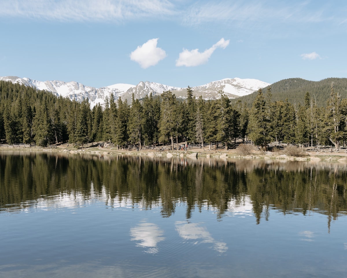
The reflection of mountains and trees in the water of Echo Lake at the start of the hike
4. Mt. Snitkau
Trail Basics
- Distance: 3.6 miles
- Type: Out-and-back
- Elevation Gain: 1,555 feet
- Time: 2 hours 45 minutes
- Difficulty: Hard
- Drive time from Denver: 1 hour
- Map: AllTrails
The hardest hike on the list, Mt. Snitaku is perfect for an experienced hiker looking to challenge themselves on a Denver day hike. This 13’er reaches an elevation of 13,240 feet at the summit.
To access the trailhead, you’ll drive up the iconic Loveland Pass and see breathtaking views of the mountains right from your car. Parking is free, but there are no bathrooms or water at the trailhead.
Even after living and hiking in Colorado regularly, I found this 3.6-mile hike challenging. There is no easing into this hike; as soon as you start walking, there is a steep uphill climb.
The trail is rocky, so you’ll want hiking boots with good traction and trekking poles. It is a wide and exposed trail with no trees or shade, so bring proper sun protection. If you’re hiking in winter, you will need traction devices like microspikes and warm layers.
After hiking for about 0.8 miles, you will reach the junction where the trail splits for Mt. Snitkau and Mt. Cupid. Take the trail to the left for Mt. Snitkau.
Around 1.2 miles, there is a minor Class 2 small rock scramble where the trail becomes a bit harder to navigate, and you may need to use your hands for extra balance. I looked for cairns along the trail to navigate this boulder section, but I recommend downloading the AllTrails map ahead of time just in case.
As soon as you reach the top of Class 2, you’ll see where the dirt trail continues to Mt. Snitkau. After hiking another half mile along the trail, you’ll reach the narrow ridge to the summit.
Once you arrive at the summit, you will see breathtaking views of Torreys Peak and Grizzly Peak behind a small, blue alpine lake in the distance. The summit can be windy and cold depending on the day (even when I hiked in early July), but if the conditions aren’t too bad, I recommend stopping here for a quick hiking snack.
If you want to extend the hike and bag two 13’ers in a day, people often hike back to the junction and take the trail to Mt. Cupid. This will add another 1.6 miles to your hike and about 450 feet more elevation gain.
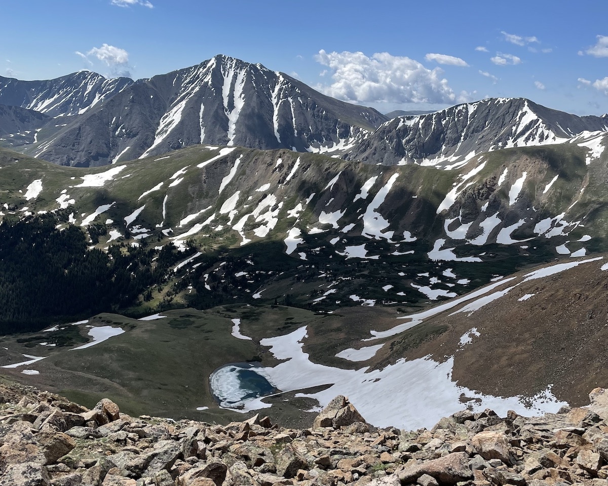
View of an alpine lake and mountain peaks from the summit of Mt. Snitkau
5. Mayhem Gulch and Juniper Loop Trail
Trail Basics
- Distance: 4.7 miles
- Type: Loop
- Elevation Gain: 797 feet
- Time: 2 hours 15 minutes
- Difficulty: Moderate
- Drive time from Denver: 40 minutes
- Map: AllTrails
The Mayhem Gulch and Juniper Loop Trail is a pleasant day hike in Denver for someone looking for a less popular or crowded option. Only a 40-minute drive from Denver, this hike delivers gorgeous views of juniper trees and mountain peaks.
The trailhead has vault toilets but no water. It is free to park in the lot. There is a pleasant mix of sunny stretches and shaded sections along the trail, so bring sun protection.
The trail is a dirt path with some rock scree. It can be a little slick at parts, so wear hiking shoes with good traction. I personally wore hiking sandals and was fine.
Although this hike is listed as a loop, it is more of a lollipop shape. You will gain the majority of the elevation (600 feet) over the first 1.5 miles of the “stick” section of the lollipop.
The stick section winds through a forest. Once you reach the fork for the loop, you can head either clockwise or counterclockwise.
I hiked clockwise, but I don’t think there is a clear advantage to either direction. Both are equal amounts challenging and have similar views.
Along the loop portion of the trail, you will see stunning views of mountain peaks. There is also an open meadow perfect for photos and a picnic in the sun.
Check if it’s a bike or hike day
On certain days, this trail is only open to mountain bikers and hiking is not allowed. Currently, even calendar days are bike-only. Double-check the Jefferson County Open Space website and read the signage at the trailhead before you begin the hike.
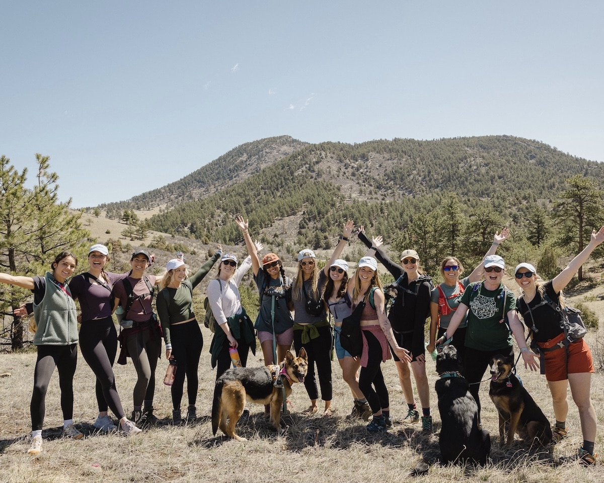
Posing for a photo with my friends during a group hike in a meadow along the trail
6. Lake Isabelle
Trail Basics
- Distance: 6.6 miles
- Type: Loop
- Elevation Gain: 672 feet
- Time: 2 hours 30 minutes
- Difficulty: Moderate
- Drive time from Denver: 1 hour 20 minutes
- Map: AllTrails
I saved the best hike for last! Lake Isabelle is probably in my top 5 favorite hikes in all of Colorado. Although it is slightly further than an hour from Denver at 1 hour 20 minutes, it is worth the trip if you have the time.
It is also the only hike on the list that requires a permit purchased in advance. You must purchase a day-use permit to park at Brainard Lake through Recreation.gov before you drive to the trailhead (there is no cell service in the Brainard Lake Recreation Area, and permits often sell out in the summer).
Permits cost $14 plus a $2 reservation fee, and they are released on a 14-day rolling window. You must either print or screenshot your permit before driving to the trailhead.
The trail makes a lollipop with two sticks on both sides. The first (and last) 0.4 miles of the hike aren’t particularly scenic as you walk along the paved Brainard Lake Road to access the trail.
This is the only boring section, though. Once you reach the forested section with a dirt path and trees, you will pass Long Lake on your right. This lake is gorgeous in its own right, and you will see the other side of the lake on your way down.
You will continue to wind through the forest on a relatively flat, smooth trail. At about 2.2 miles, you will reach a small wooden bridge and cross over a stream that connects Lake Isabelle and Long Lake.
At 2.3 miles, you will reach a fork in the trail. You will take the trail left to Lake Isabelle; you’ll eventually take the fork in the other direction on the way down to form the loop and see the other side of Long Lake.
As you approach Lake Isabelle, you will see a meadow to the left. You can typically spot moose in the distance (I have seen them here on three separate occasions).
Around 3.1 miles, you must cross over some boulders with running water to reach Lake Isabelle. Go slow and watch your step – this section can be slick and is challenging for many people.
If you walk a little further, you’ll arrive at Lake Isabelle and see the beautiful snowy peaks of Niwot Ridge, Navajo Peak, Navajo Glacier, Apache Peak, and Shoshoni Peak with the clear blue water of Lake Isabelle in front. This breathtaking view of the mountains with the alpine lake is what makes it one of my favorite hikes.
It is a scenic spot to enjoy a hiking snack and take in the views. In the summer months, you can bring a swimsuit and jump in the water for a swim.
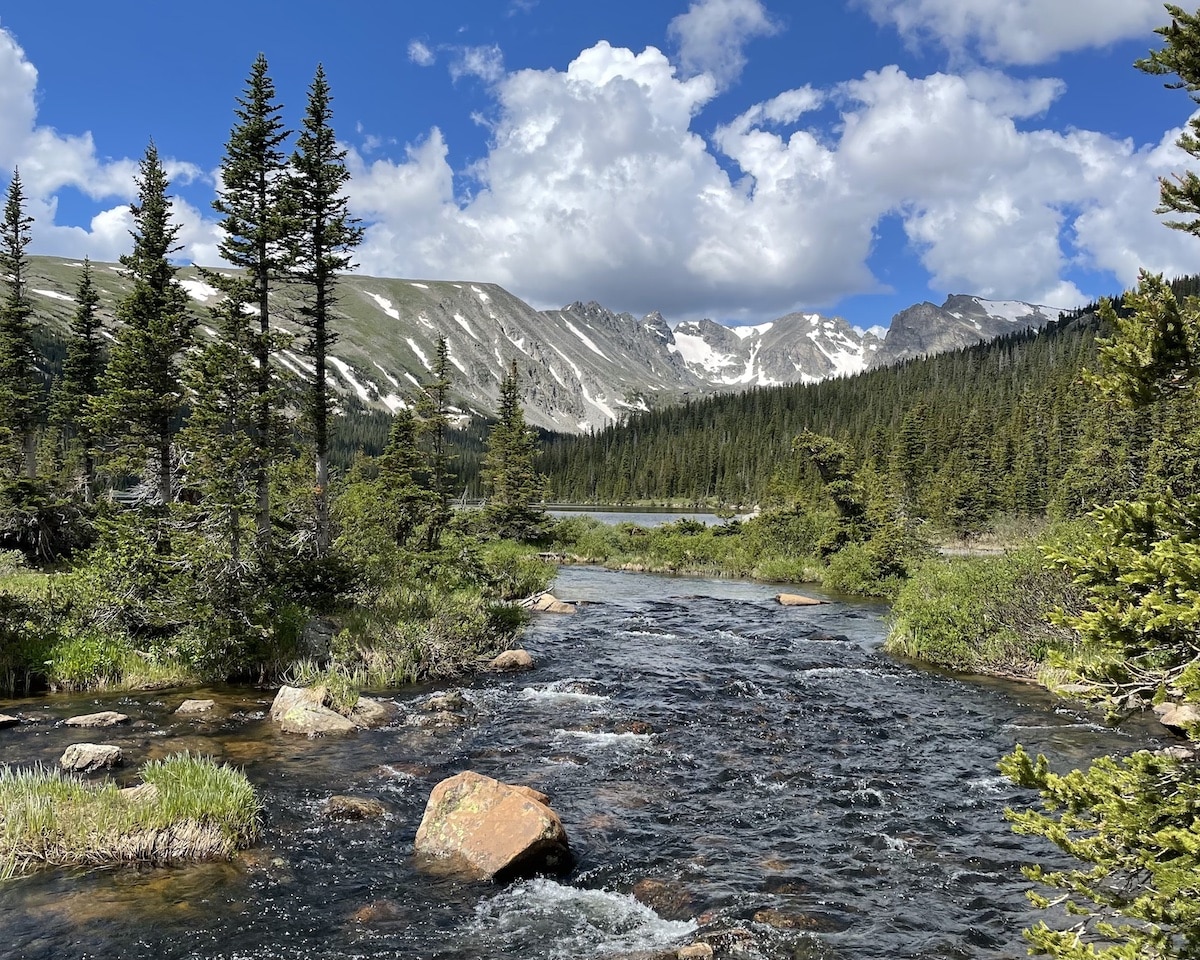
There are beautiful sights of trees, water, and mountains along the way to Lake Isabelle
Best Time of Year to Hike in Denver
With 300 days of sunshine, there are pleasant hiking conditions in Denver throughout the year. It ultimately depends on whether you prefer to hike in the snow.
Summer
For the best chance of clear trail conditions, I recommend hiking from May through September for hikes below 10,000 feet. For hikes above 10,000 feet in elevation, you may need to wait until late June or early July for the snow and ice to melt.
Summer is also wildflower season in Colorado. You will see gorgeous flowers like Blue Columbine and Indian Paintbrush on many trails while hiking in July.
In high elevations, the summer air still feels cool while hiking. In addition to sun protection, bring a lightweight jacket to feel comfortable while hanging out at the summit.
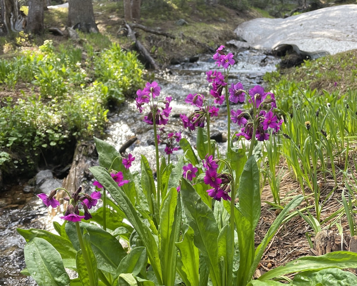
Wildflowers along the trail while hiking in the summer to Lake Isabelle
Fall
Fall is one of my favorite seasons to hike in Colorado. If you pick a trail with aspen trees, you will enjoy beautiful golden leaves fluttering around you.
Temperatures in the fall are still pleasant for hiking, but towards the end of September, there is a risk of snow in the mountains at high elevations. Even if the weather seems nice in Denver, it can be a night-and-day difference once you head to the mountains.
Be sure to wear fall hiking apparel and check trail conditions before driving an hour to a higher elevation.
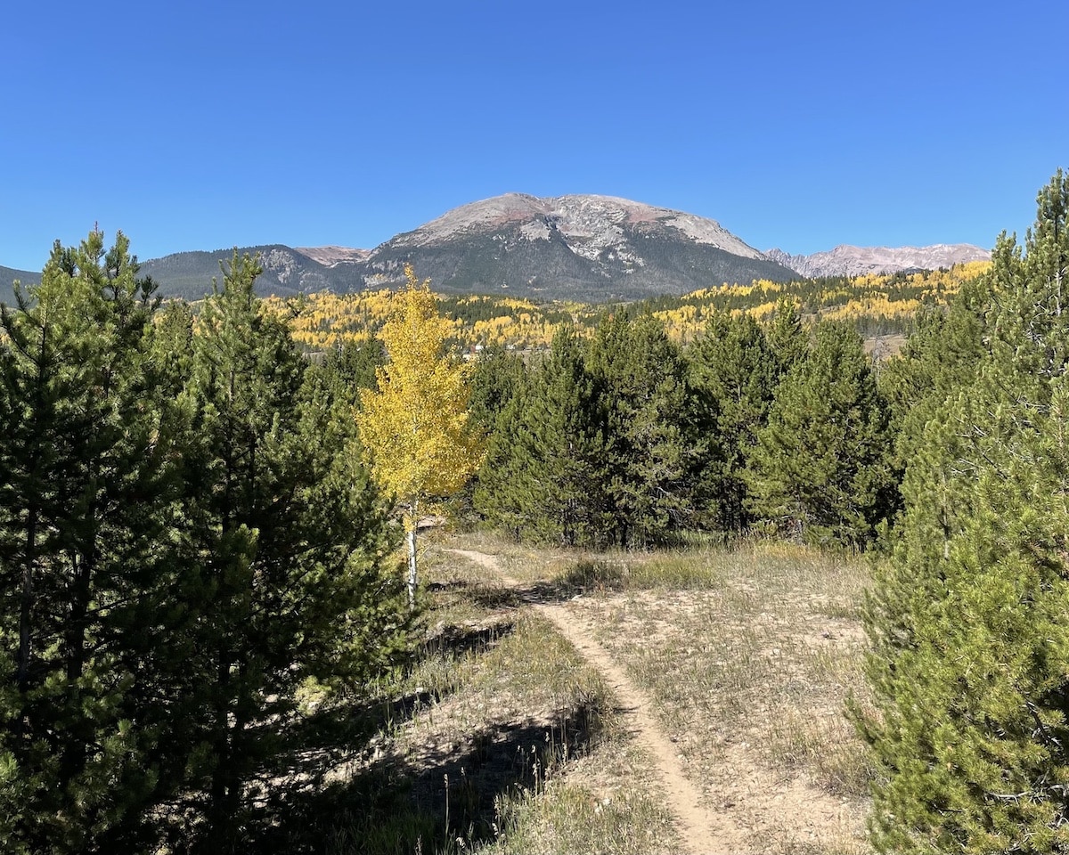
Fall is the prime leaf-peeping season in Colorado as the aspen leaves turn golden yellow
Winter
If you visit Colorado during the winter, you must come prepared. Depending on the depth of the snow and the amount of ice on the trail, I recommend hiking with winter traction devices like snowshoes or microspikes. I usually check AllTrails before driving to the trailhead to read recent trail reports.
Some of the trails on this list travel through avalanche terrain, so unless you have taken an avalanche course and have the proper equipment, you should stick to gentler terrain like that you’ll find on the Red Rocks Trading Post trail. You can check current warnings with the Colorado Avalanche Information Center before hitting the trail.
The paved roads leading to the trailheads on this list may also be inaccessible if they haven’t been plowed. Check for road closures and drive a vehicle that handles well in snow. I’ve gotten stuck at a trailhead (even in a 4×4 vehicle) and relied on the kindness of a stranger to pull me out.
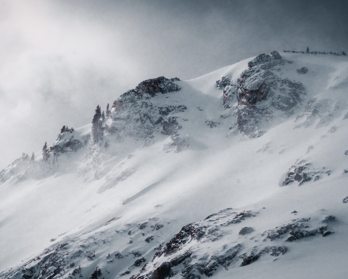
Snow blowing on top of Saint Mary’s Glacier in January in Colorado
Spring
Spring is tough for hiking in Denver due to the trail conditions. Some trails still have snow and ice, while others have TONS of mud from the melting snow.
However, there are often fewer crowds in the spring, which makes it easier to find parking at popular trailheads and enjoy peace on the trails. There are also often sunny skies in March and April with pleasant hiking temperatures.
Spring hikes in Colorado often feature snow and mud along the trail, but the trade-off is fewer people
Tips for Hiking in Denver
Before you hit the trails in Colorado, read these tips to ensure a safe and enjoyable experience in the Rocky Mountains.
- Adjust to the elevation: If you are arriving in Denver from a lower elevation, spend a few days in the city adjusting before you hit the trails. Relax, hydrate, and avoid alcohol to reduce your chances of experiencing altitude sickness on the trails. If you want to do a hike over 10,000 feet, consider starting with a hike at a lower elevation first and working your way up.
- Hydrate: Drink plenty of water each day leading up to your hike. I usually drink a gallon of water per day a few days before I have a big hike planned so my body is well-hydrated. This helps me avoid cramps on the trail.
- Bring sun protection: With 300 days of sunshine in Colorado, you will likely have sunny conditions on your hike no matter what time of year you visit. Make sure to pack accordingly with a sun hat, sunglasses, sunscreen, and a sun protection shirt.
- Prepare for no cell service: Many of the hikes in Denver have no cell phone service along the trail due to the mountains blocking the cell towers. Download trail maps and permits ahead of time, and bring a Garmin inReach in case of emergency.
- Be aware of your surroundings: Although Colorado is relatively safe, it is important to pay attention to other people around you, especially when hiking alone. Hike with another person if possible, and always leave one earbud out if listening to music. Tell someone where you are going and when they should expect to hear from you afterward, and always be aware of your surroundings.
- Be aware of wildlife: There are black bears, mountain lions, moose, and other wildlife in Colorado. Do not approach wildlife and keep a safe distance away if you encounter an animal on the trail. You can rent or purchase bear spray to carry with you on hikes for protection.
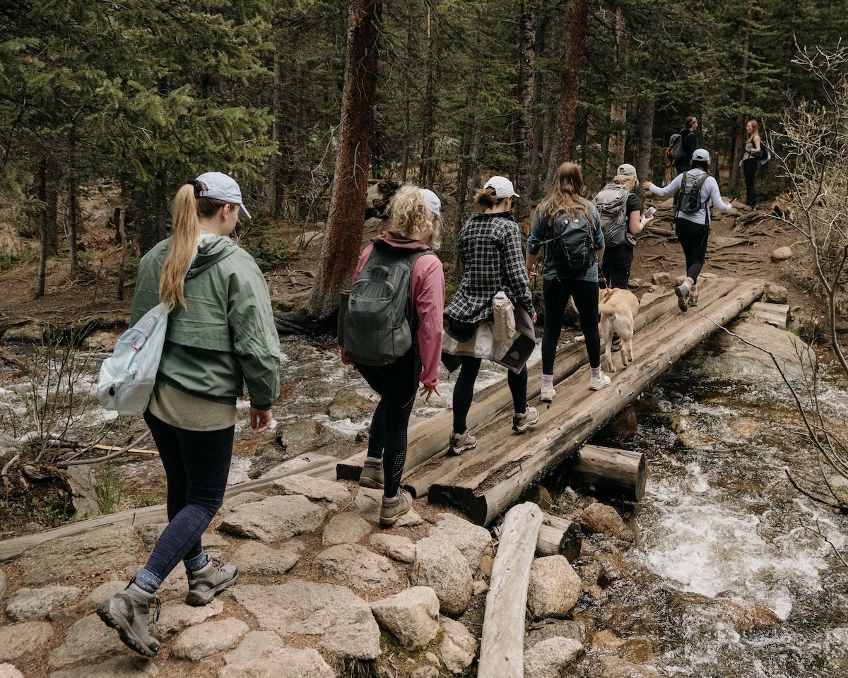
Hiking with another person or a group is both fun and a good safety precaution
Planning a trip to Colorado? Check out these other outdoor activities:
Save this post to Pinterest
Have you hiked in Colorado? What do you think is the best day hike in Denver? I’d love to hear about your favorite trail in the comments.
The post 6 Best Hikes Within One Hour of Denver appeared first on Bearfoot Theory.
https://bearfoottheory.com/best-hikes-in-denver/
 CampingSurvivalistHuntingFishingExploringHikingPrivacy PolicyTerms And Conditions